How I found confidence and sense getting back on track in the Norwegian woods. I was lost outside the prepped gravel paths of the norwegian woods – Østmarka for 24 hours ! Tips to you in case your battery gets flat in a similar scenario.
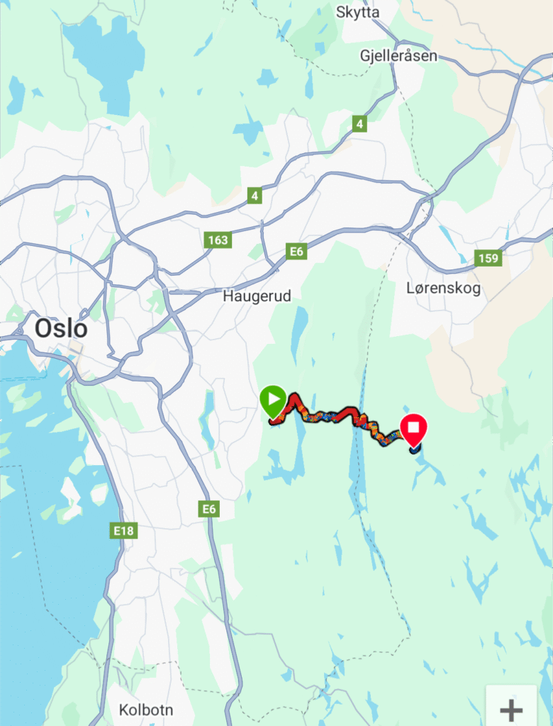
I spent the national holidays deep inside the Norwegian woods hiking for three days and camping in a tent for two nights in a row.
During the time spent away from my home I got lost in the woods for over 24 hours.
This is how I found the way back to the path hiking towards my goal destination with the name: “The bridge of the shooters “returning safely home again.
I was prepared.
At trips like these; food and water dominates most of the carried weight. I had allready precooked the dinners for four meals and dividing the rations in separate bags. In addition to precooked dinners I brought wholewheat biscuits, cheese and a lot of snacks and candies! (It was going to be a national day celebration after all 🙂
With tent, sleeping bag, cooking gear, clothes and a book I carried 5 kilo of water with the rest of the gear and food.
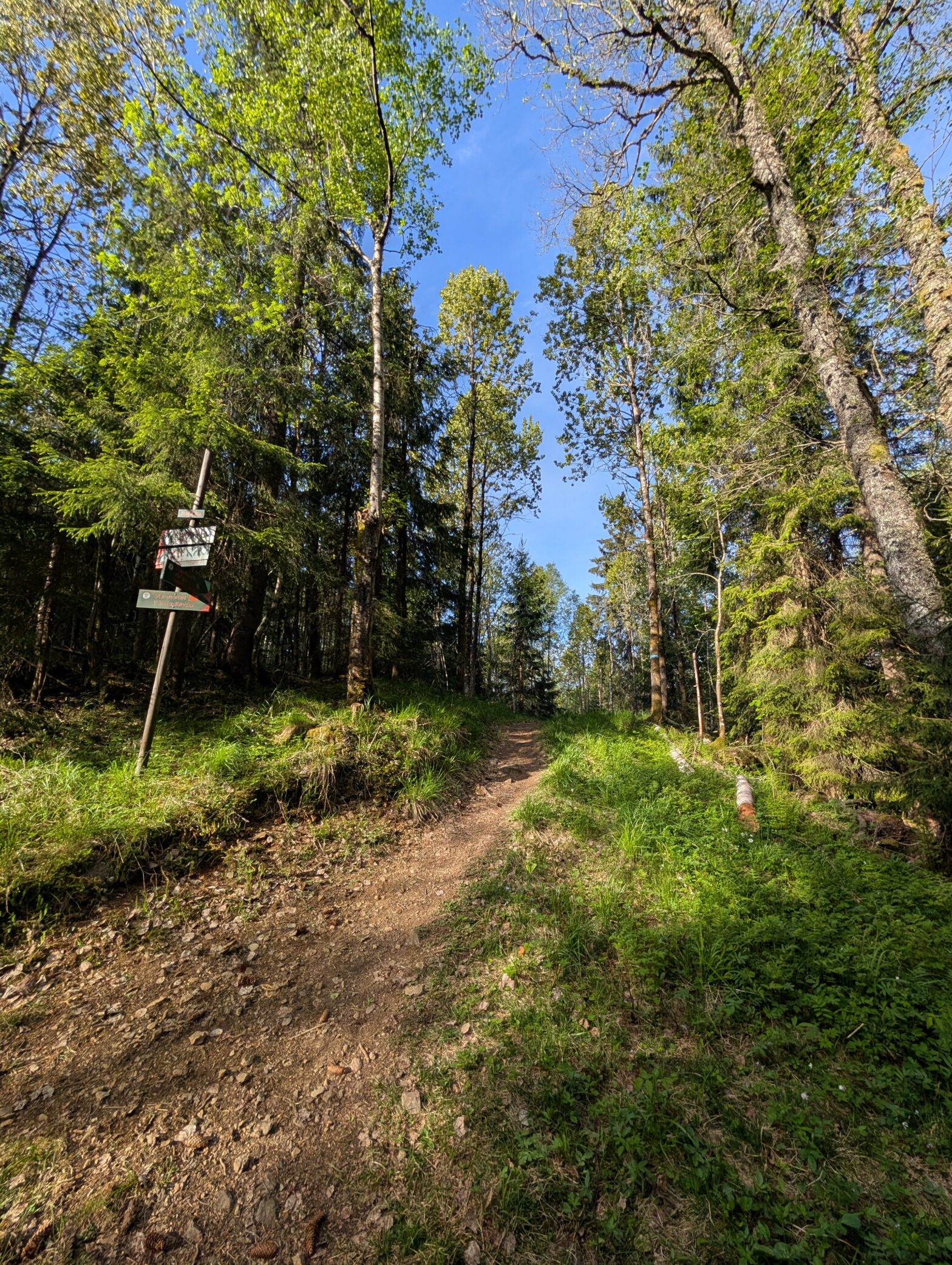
It was easy at the start following a prepped road to the first lake and from there following marked trails to the second lake there I met three young people by coincidence. This was the last persons I were to see for the next days.
Assumptions made me make a fatal decision.
From the second lake I followed a marked trail surrounded by beautiful woods I came to a valley with power grid lines. At this point I made the fatal decision. I should have been crossing the valley in order to continue to the third lake.
Since I had been in this valley before I assumed crossing the valley would be wrong according to my own memories from another day I went for a different trip.
I hiked a fatal right and followed the narrow path downhill the valley. This path narrowed to a dead end in a ditch of soggy grass and dirt. (marsh)
My second mistake was that I realised my mistake but kept hiking forwards order to overcome obstacles of terrain. I also made this stupid plan of fixing the destination route where I was planning to sleep the first night. This decision resulted in sinking in mud, jumping, climbing at dead trees, swearing and climbing again steep uphill to get away from that ditch.
At safe ground the sun was starting to set 2 hours before my estimations. In the deep woods there are quite tall trees. The sun is setting at an earlier point of time because of the heights of the trees. (Like an extra tall wall)
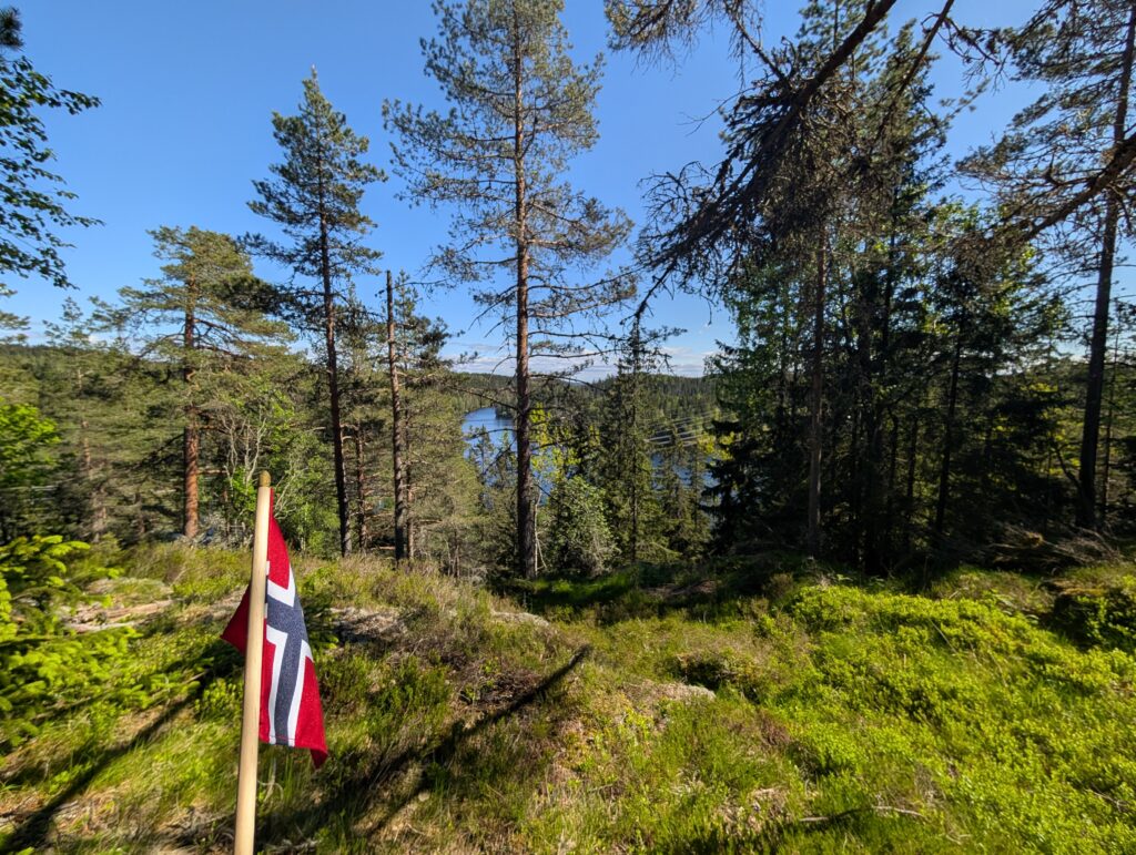
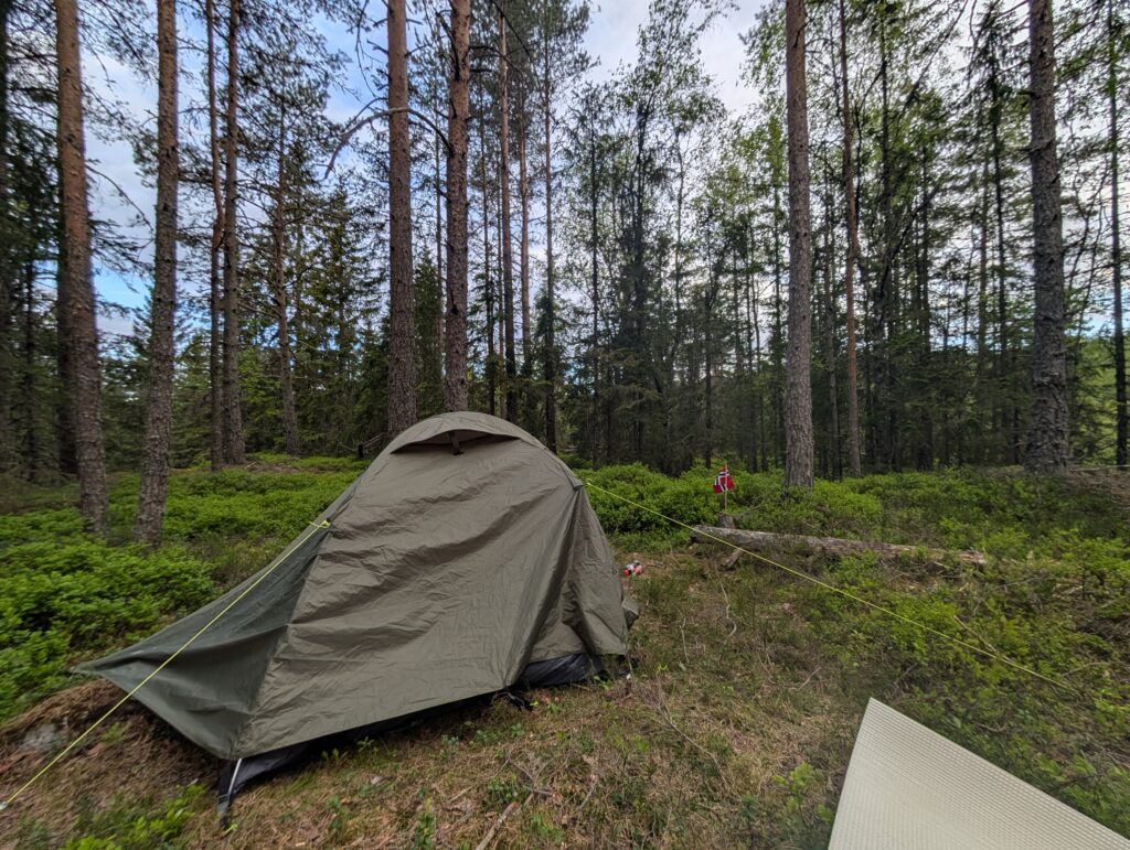
I searched to higher ground at a fast speed and climbed upon a small hill that was flat on the top. At the top I got an overview of the hill and the surrounded environment before I sat my tent.
I had no Idea where I really was. And then it was dark.
The next 24 hours counting from the national holiday I was lost, but not too stressed though. I delayed the next morning, taking time to eat, think, relax, taking photos and read until the afternoon and I made a plan thinking it was safe.
Hiking deeper into the woods with my new planned route starting to navigate firstly with physical map and my physical compass. It was also a beautiful experience of hiking rich surroundings of nature at different kind of paths feeling confident about the direction.
Hiking downhill, I lost my compass.
My attempts to navigate with compass app combining it with my physical map was successful until I realize I was seriously hiking in circles. I fired up Maps to find my location. And from this point I only used the apps. After 5 hours I was still lost and hiking I circles. I remember I had some tiny panic when I open all the apps I had with GPS location as well checking my smartwatch location and path.
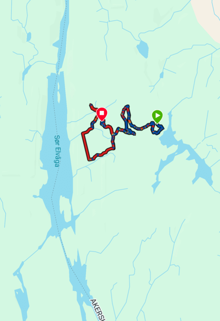
The sun was setting once again I searched higher ground finding a small square sign with orientation symbol with a QR code. I downloaded this app of Orientation and found a new GPS location where I supposedly was. This evening was not a high mood evening, cooking my dinner and eating it forgetting to salt the food because I was too tired. I had 2 litres of water left. And there were mosquitos.
If the point of location was right I was confident I was “safe”. I just had to navigate from there without the apps and with only physical map to the right paths and find the point of goal destination: “Bridge of the shooters” which was approximately 3-4K hiking.
Prioritizing sleep, taking back the control and hiking to the “bridge of shooters”
I decided to prioritize sleep and figure out that plan the next day.
I woke up at five o’clock with the sun rising and I had a good night of sleep. After studying the map and thinking: I had to hike with the sun always at my behind (back) to hike in the right direction. From the base I positioned my tent towards the sun setting. The next day I had to have the sun in my back. If the sun was positioned on the left or the right side of my body; it pointed to that I was hiking more towards north (left) or towards south (right).
Wrapping everything I started hiking with this theoretical framework in mind. ( I was the object and the sun was the other reference object – the direction goal destination was the reference target – I think you read/heard about this in math class or similar institutions)
Finding the path (and then I survived – again.)
After 40 minutes of hiking I found the path and comfortable marked signs and marked paths (!) I was so utterly happy being sure that I found the path!!!! From here I was jogging the straight way to the “Bridge of the Shooters” – really happy. Here’s is a video from my phone’s view passing that bridge. The day was really nice!
And from here it was only 5,3K at easy gravel paths in return to civilisation.
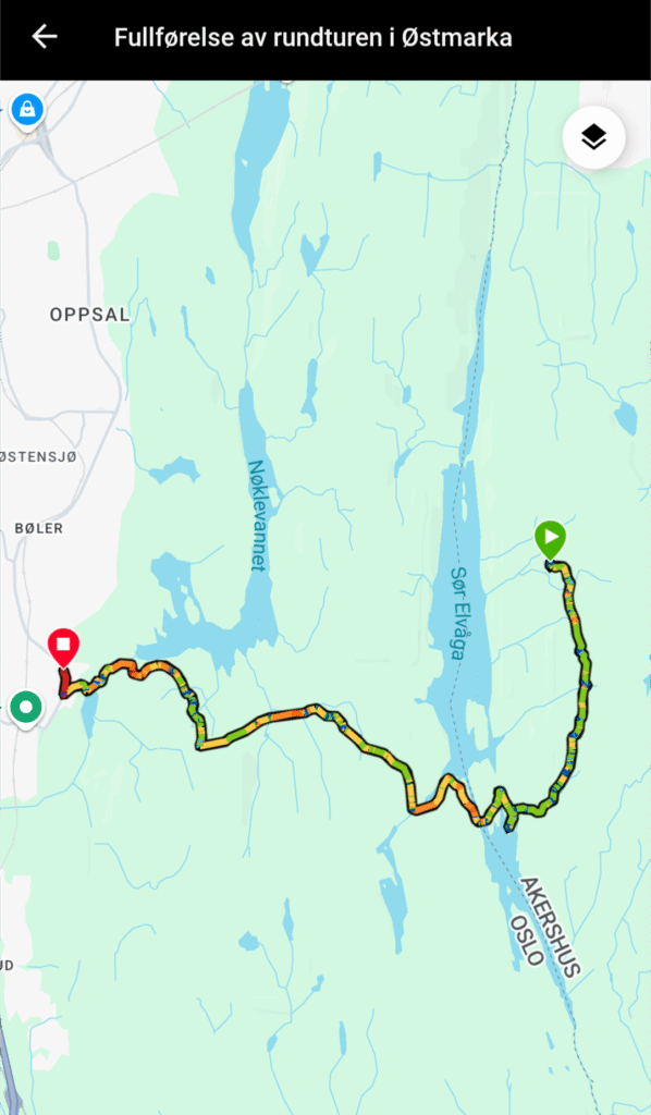
In sum I hiked for 20K during these days and was filled with memories of new exciting experiences in the Norwegian nature.
It was a great trip and I wish for all my readers to stay safe at the marked gravel paths and follow signs in the norwegian woods.